Announcing the IR Photo Competition Winners!
Many thanks to everyone that participated in the 2007 InterRidge photo competition, we had many great entries that will be extremely useful in promoting Ridge Crest science.
In the end though, we had to choose five winners from all the fabulous entries, each of these photos will be featured in the 16th edition of the InterRidge News, coming out later this year.
Here they are -
--------------------------------------------------
The Azores Triple Junction
by - Gui Manuel Machado Menezes (Investigador Auxiliar, University of the Azores)
.png)
The map shows the MAR, the islands, the numerous seamounts, and abyssal seafloor. We use the predicted bathymetric data downloaded from the site David T. Sandwell: http://topex.ucsd.edu/sandwell/sandwell.html. This data is part of the global seafloor topography from satellite altimetry and ship depth soundings. The contour maps of seafloor topography were estimated using the kringing method routine of the software Surfer vs.7.00 - Surface Mapping System, Golden Software, Inc.
--------------------------------------------------
The Great Dodo Lava Plain
by Akira Asada (IIS)

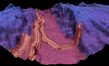
“The Great Dodo Lava Plain” in the Segment 16 of Central Indian Mid-Ocean Ridge System taken by MNBS of Hakuho-Maru (Chief Scientist : Prof. Kensaku Tamaki of the University of Tokyo) with side-scan image taken by the AUV “r2D4” on 19th of December 2006. The AUV “r2D4”, which was developed by Prof. Tamaki Ura of Institute of Industrial Science (IIS) of the University of Tokyo, cruised along the axis of the rift valley keeping low altitude (60m) from the floor, depth of which is about 2,700m. This image was composed by Prof. Akira Asada of IIS.
--------------------------------------------------
Comra Celebrations
by Dana Yoerger (WHOI)

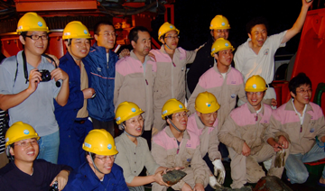
Comra scientists celebrating their successful recovery of the first active hydrothermal samples from the Southwest Indian Ridge (See News from the Ridge Crest for Details
--------------------------------------------------
FUJI Dome Oceanic Core Complex
By Roger Searle and Bralee

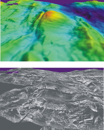
3D Fledermaus views of bathymetry (top) and TOBI sidescan draped on bathymetry (below), showing a view looking west along the south flank of the Southwest Indian Ridge near 64deg E. Seafloor in foreground is about 1 Myr (right) to 3 Myr (left). FUJI dome oceanic core complex is seen in the centre, with a clearly incised breakaway graben to its left and the termination of the smooth detachment fault at the foot of the volcanic ridge on the right. Rige axis is just out of view to the right. The top right part of the bathymetry shows the median valley deepening towards a non-transform offset trending SW into the distance on the horizon.
--------------------------------------------------
Oman Ophiolite
By David Jousselin (Nancy Université-CRPG)

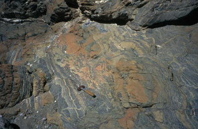
Outcrop of a chromite pod at the top of the mantle section in the Oman ophiolite; chromite is used as an indicator of intense melt circulation in the uppermost mantle. A thin train of chromite grains, and podiform chromitites have recently been recovered at Hess Deep, ODP site 895 and at the MAR15°N ODP site 1271 respectively.


